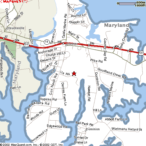
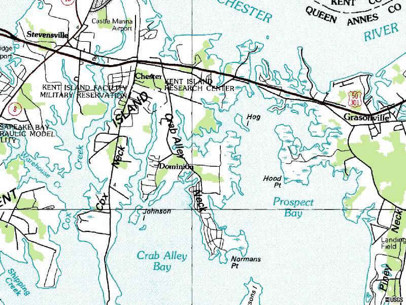
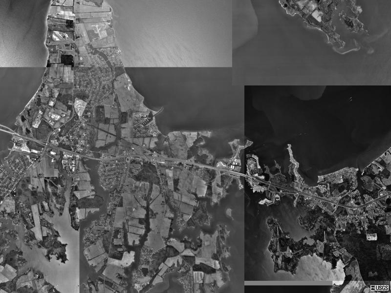
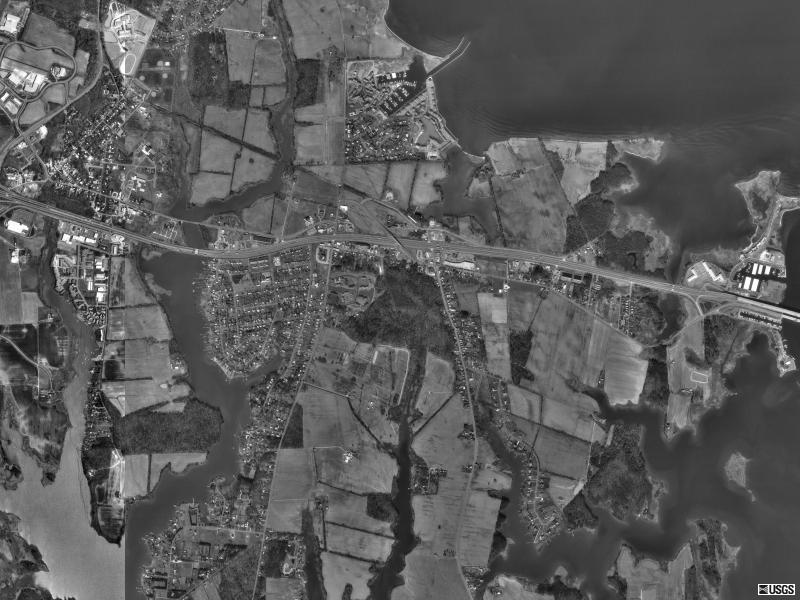
28 June 2002
Sources: Mapquest.com (color);
TerraServer (monochrome).
James Bamford writes in The Puzzle Palace: Inside the National Security
Agency, America's Most Secret Intelligence Organization, Penguin, 1982,
(paper) pp. 230-31:
Although some microwave testing may be done by engineers in NSA research
and development spaces in the floors below the big white golf ball at FANX,
most of it, apparently, is conducted in the utmost secrecy at a mosquito-filled
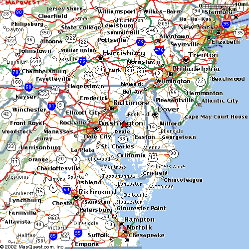
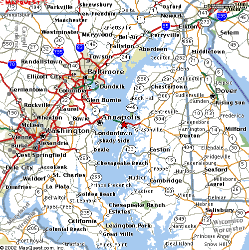
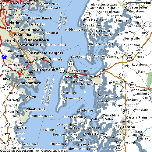
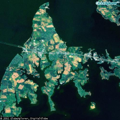
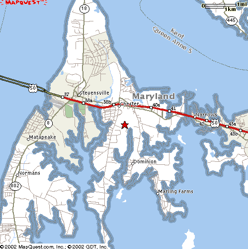
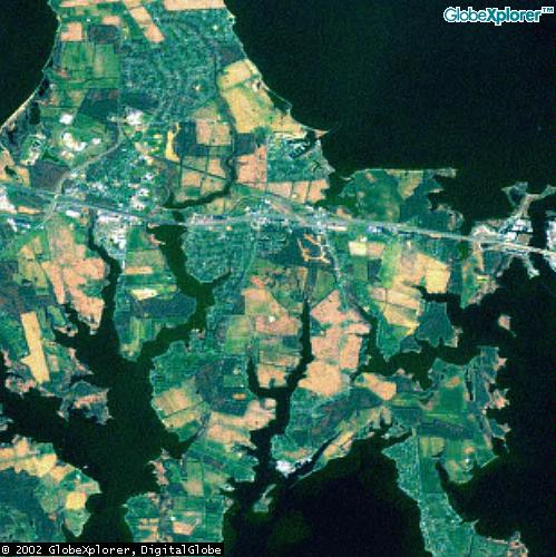
swamp on Kent Island in the Chesapeake Bay.
Using the Army Corps of Engineers as a go-between, the NSA in January 1961
negotiated a five-year lease for the 210 acres on Cox Neck Road with the
Diamond Construction Company of Savannah, Georgia, at a rent of $4500 per
year. Four years later, on February 24, 1965, the NSA executed its option
and purchased the site for $48,500.
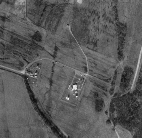
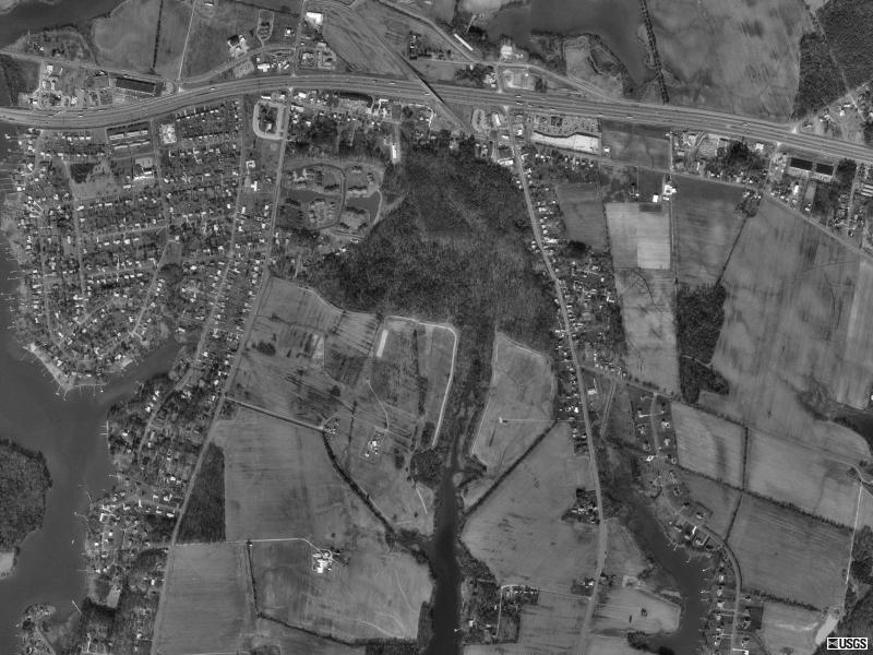
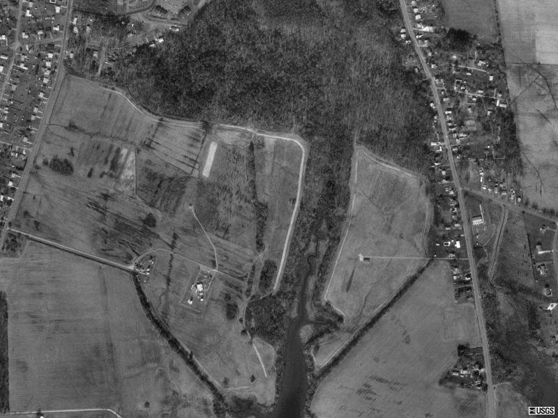
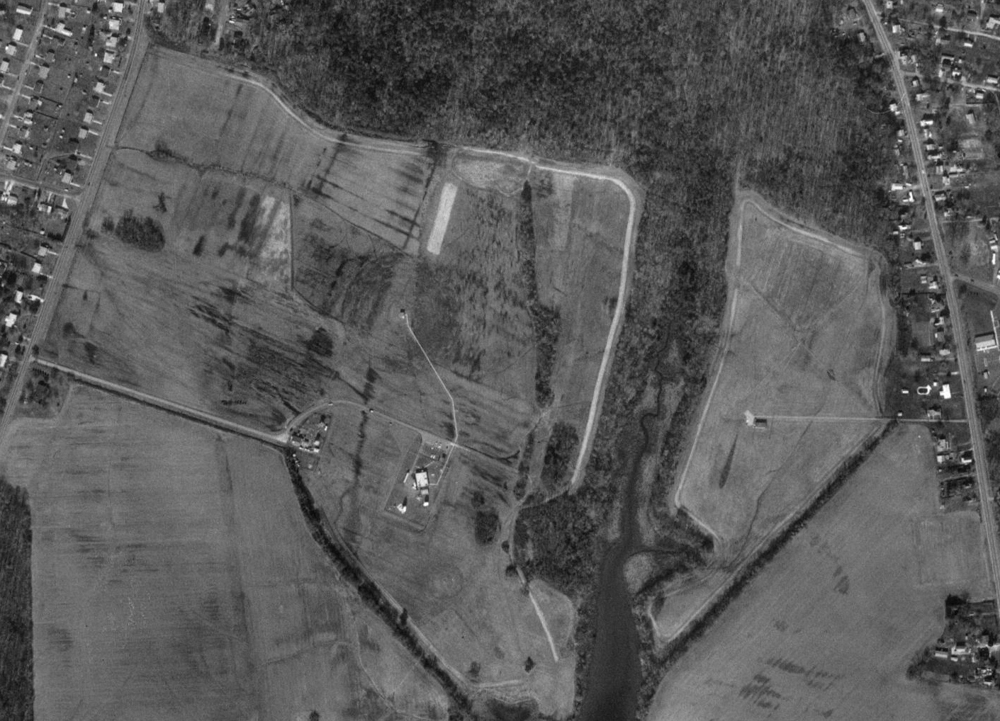
Considered a "classified facility" by NSA, the location consists of a one-story,
white, windowless NSA Propagation Research Laboratory, which houses between
$250,000 and $350,000 worth of automatically operating, unattended equipment.
Also on the site is a small, white, cinder-block control building inside
a barbedwire-topped chain-link fence. Near the control building are a number
of unusual antennas. One is an awkward-looking radio direction finder --
a large, steerable, rectangular antenna resting on top of an air-conditioned,
windowed control room raised one story above the ground. Another appears
to be a satellite transmitting antenna built atop a two-story platform. Others
are a round, white radome raised about a dozen feet above the ground; a
high-frequency, broadband, rotatable log-periodic antenna on top of a seven-story
tower with a small, dish-shaped microwave parabolic reflector at its base;
a low-frequency long wire antenna;, numerous high-frequency antennas atop
sixty-foot telephone poles; and, finally, what seem to be several microwave
horn radiator antennas resting on the ground inside the fence and, apparently,
another horn-type antenna on top of another seven-story tower.
Known within the R and E spaces of the Puzzle Palace as the Kent Island Research
Facility, its purpose was explained by former NSA deputy director Louis Tordella
during a closed-door hearing before a Senate subcommittee. The Agency established
the facility, said Tordella, "for the conduct of research and evaluations
on very-high-frequency and microwave antenna systems. These systems are peculiar
to the Agency's mission. The area utilized to conduct this type of research
and evaluation must have a low radio noise interference level. The types
of antennas used in these systems require a wide, unobstructed view of the
horizon. The size of the Kent Island tract (210 acres) is adequate to allow
experimentation and development of several compatible projects simultaneously."
More specifically, as Tordella elaborated at another time, "we are on Kent
Island ... examining anomalous propagation effects and other peculiarities
associated with our problem of intercept of communications....
Although the facility is largely automatic and unmanned, it does have one
resident engineer, Harry (Link) George, a burly island resident. "I'm the
chief and crew," George said when asked how many people work there, adding,
"It's a crew of one." With regard to the owner of the, facility, however,
all he would say was that it was part of the Department of Defense: "Anything
other than that I can't say."
Excerpt from 24 August 1990 memorandum by US Army Corps of Engineer, Baltimore
District, on the wooded northern portion of the site no longer used by NSA:
http://pirs.mvr.usace.army.mil/fuds/I-l/kent/preasses/inpr/11b.pdf
1. A 31.34 acre tract which was formerly part of the Kent Island Facility
is located between Cox Neck Road and Maryland Route 552, just south of the
Town of Chester, Maryland. There are 178.66 acres fee and 0.16 of an acre
easement of the Kent Island Facility currently active. The current owner
[of the inactive portion] is the State of Maryland, Department of
Natural Resources.
2. A tract containing 210 acres of fee land, and 0.16 acre of easement was
conveyed to the United States of America by B. F. Diamond Construction Company,
Inc., by deed dated 24 February 1965. This property was acquired for the
National Security Agency for an antenna site and an access road subject to
a graveyard reservation recorded in Liber SS#2, Folio 274, together with
rights of ingress and egress to burial site.
3. A site visit conducted on 18 November 1988 revealed that the 31.34 acre
parcel was utilized by the National Security Agency as a radar facility buffer
zone. No structures or utilities were constructed on the site. DOD maintained
control over the property during the period of DOD ownership.
|